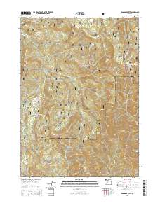
2014 Map of Ragsdale Butte
USGS Topo · Published 2014About this map
The Bark School stands near the headwaters of Joe Hall Cr in this portion of the Southern Oregon Cascades. The landscape is defined by its dramatic volcanic geology, featuring prominent landmarks such as Ragsdale Butte, Pilot Rock, and Alco Rock. Much of the area is managed as part of the Umpqua National Forest and Rogue River National Forest, with the Douglas and Jackson county line cutting through the center of the terrain.
Find a feature on this map
49 named features on this map. Tap any name to fly to it.
Don’t see what you’re looking for? This feature index may not catch every label — zoom into the map to look around manually.
Map Details
Editions of this 2014 Ragsdale Butte Map
This is the sole edition of this map. No revisions or reprints were ever made.
Other maps of this area

1891 · Ashland
USGS Topo · 1:250,000

1893 · Ashland
USGS Topo · 1:250,000

1897 · Ashland
USGS Topo · 1:250,000

1943 · Trail
USGS Topo · 1:62,500

1944 · Tiller
USGS Topo · 1:62,500

1944 · Abbott Butte
USGS Topo · 1:62,500

1947 · Abbott Butte
USGS Topo · 1:62,500

1954 · Butte Falls
USGS Topo · 1:62,500

1955 · Medford
USGS Topo · 1:250,000

1957 · Medford
USGS Topo · 1:250,000