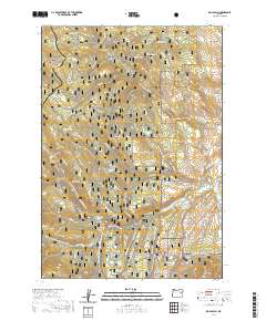
2020 Map of Rail Gulch
USGS Topo · Published 2020About this map
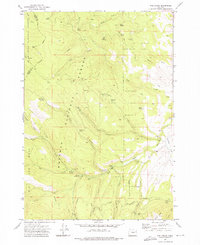
The high-elevation divide between the Malheur National Forest and Whitman National Forest defines this landscape in the southern Blue Mountains. Straddling the Grant and Baker county line, the area is dominated by complex water management and seasonal access routes. The S Fork Burnt River and its tributaries, such as Sheep Cr and Elk Cr, are fed by numerous named springs including Mammoth Spring and Tamarack Spring. Human engineering for water transport is evident in the presence of Cavin Ditch and Elms Ditch, which redirect flow across the high plateaus. The modern recreational character of the land is visible through an extensive network of off-highway vehicle and snowmobile trails, such as the Blue Mtn Ohv-1 and Pole Creek Snowmobile, which provide passage through landmarks like Buck Mtn and Mine Ridge.
Find a feature on this map
64 named features on this map. Tap any name to fly to it.
Don’t see what you’re looking for? This feature index may not catch every label — zoom into the map to look around manually.
Map Details
Editions of this 2020 Rail Gulch Map
This is the sole edition of this map. No revisions or reprints were ever made.
Other maps of this area

1901 · Sumpter
USGS Topo · 1:125,000

1908 · Ironside Mountain
USGS Topo · 1:125,000

1955 · Canyon City
USGS Topo · 1:250,000

1959 · Canyon City
USGS Topo · 1:250,000

1972 · Austin
USGS Topo · 1:24,000
1972 · Unity
USGS Topo · 1:24,000
1972 · Deardorff Mtn
USGS Topo · 1:24,000
1972 · Bullrun Rock
USGS Topo · 1:24,000
1972 · Rail Gulch
USGS Topo · 1:24,000
1972 · Unity Reservoir
USGS Topo · 1:24,000