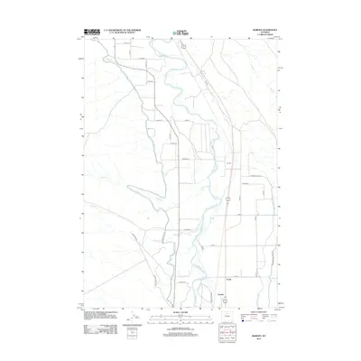
2012 Map of Rairden
USGS Topo · Published 2012About this map
The Bighorn River corridor defines this part of Washakie County, where a sophisticated network of irrigation infrastructure supports the arid landscape. The Big Horn Canal and Fritz Canal parallel the river's winding path, while the Lower Hanover Canal serves the eastern reaches. This intricate water system allows for agricultural life near small settlements like Rairden and Eccles, which are situated along the primary north-south transport routes. To the southwest, the industrial footprint of the Devon Oilfield and its network of roads like Devon Oilfield Rd signal the importance of energy extraction in the region. The map also traces several drainage patterns, including Fivemile Cr and Sixmile Cr, which flow toward the central river valley.
Find a feature on this map
38 named features on this map. Tap any name to fly to it.
Don’t see what you’re looking for? This feature index may not catch every label — zoom into the map to look around manually.
Map Details
Editions of this 2012 Rairden Map
This is the sole edition of this map. No revisions or reprints were ever made.
Other maps of this area

1951 · Schuster Flats NE
USGS Topo · 1:24,000

1951 · Schuster Flats SE
USGS Topo · 1:24,000

1955 · Cody
USGS Topo · 1:250,000

1955 · Sheridan
USGS Topo · 1:250,000

1958 · Cody
USGS Topo · 1:250,000

1958 · Sheridan
USGS Topo · 1:250,000

1960 · Manderson
USGS Topo · 1:24,000

1960 · Manderson SE
USGS Topo · 1:24,000

1962 · Sheridan
USGS Topo · 1:250,000

1962 · Cody
USGS Topo · 1:250,000