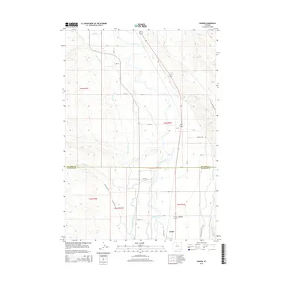
2015 Map of Rairden
USGS Topo · Published 2015About this map
The Bighorn River corridor defines this portion of the Bighorn Basin, where an intricate network of irrigation infrastructure supports the arid landscape. Major engineering works like the Big Horn Canal, Fritz Canal, and Hanover Canal parallel the river, tracing the contours of the valley to sustain local agriculture. Small settlements and sidings such as Rairden, Eccles, and Durkee anchor the eastern side of the river, linked by a grid of rural routes including Rairden Ln and Game Reserve Rd. The terrain transitions from the fertile river bottom to the high desert, marked by seasonal drainages like Fivemile Cr and Sixmile Cr. Industrial activity is evident near the western boundary with Devon Oilfield Rd, reflecting the region's energy resources. This survey also captures the jurisdictional divide at the Big Horn Co Washakie Co line.
Find a feature on this map
35 named features on this map. Tap any name to fly to it.
Don’t see what you’re looking for? This feature index may not catch every label — zoom into the map to look around manually.
Map Details
Editions of this 2015 Rairden Map
This is the sole edition of this map. No revisions or reprints were ever made.
Other maps of this area

1951 · Schuster Flats NE
USGS Topo · 1:24,000

1951 · Schuster Flats SE
USGS Topo · 1:24,000

1955 · Cody
USGS Topo · 1:250,000

1955 · Sheridan
USGS Topo · 1:250,000

1958 · Cody
USGS Topo · 1:250,000

1958 · Sheridan
USGS Topo · 1:250,000

1960 · Manderson
USGS Topo · 1:24,000

1960 · Manderson SE
USGS Topo · 1:24,000

1962 · Sheridan
USGS Topo · 1:250,000

1962 · Cody
USGS Topo · 1:250,000