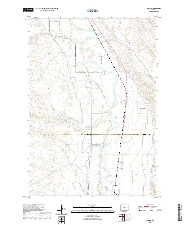
2021 Map of Rairden
USGS Topo · Published 2021About this map
The Bighorn River valley defines this landscape along the border of Big Horn and Washakie counties. The map reveals a complex irrigation infrastructure essential to the high desert climate, including the Big Horn Canal, Fritz Canal, and the Upper Hanover Canal. Small settlements like Rairden and Durkee anchor the agrarian and industrial activities of the region. The southern portion of the map is dominated by energy extraction at the Devon Oilfield, with access provided by the Devon Oilfield Rd. This intersection of water management and petroleum extraction illustrates the dual nature of Wyoming’s rural economy. From the banks of Fivemile Cr to the reaches of the Lower Hanover Canal, the survey traces the persistence of small-scale hubs in a landscape of coordinated natural resource development.
Find a feature on this map
32 named features on this map. Tap any name to fly to it.
Don’t see what you’re looking for? This feature index may not catch every label — zoom into the map to look around manually.
Map Details
Editions of this 2021 Rairden Map
This is the sole edition of this map. No revisions or reprints were ever made.
Other maps of this area

1951 · Schuster Flats NE
USGS Topo · 1:24,000

1951 · Schuster Flats SE
USGS Topo · 1:24,000

1955 · Cody
USGS Topo · 1:250,000

1955 · Sheridan
USGS Topo · 1:250,000

1958 · Cody
USGS Topo · 1:250,000

1958 · Sheridan
USGS Topo · 1:250,000

1960 · Manderson
USGS Topo · 1:24,000

1960 · Manderson SE
USGS Topo · 1:24,000

1962 · Sheridan
USGS Topo · 1:250,000

1962 · Cody
USGS Topo · 1:250,000