
1951 Map of Raleigh
USGS Topo · Published 1952About this map
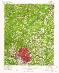
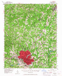
The growing capital city of Raleigh anchors this 1951 revision, reflecting a mid-century landscape of established institutional grounds and rural crossroads. The city's western reach is defined by the Meredith College campus and the State Fairgrounds, while smaller surrounding communities like Method and Nazareth maintain distinct identities before later annexation. To the north, the Neuse River winds through a terrain of scattered homesteads and small family-named landmarks like Adam Mountain.
Find a feature on this map
87 named features on this map. Tap any name to fly to it.
Don’t see what you’re looking for? This feature index may not catch every label — zoom into the map to look around manually.
Map Details
Editions of this 1951 Raleigh Map
3 editions found
Other maps of this area

1943 · Durham South
USGS Topo · 1:62,500

1943 · Raleigh
USGS Topo · 1:62,500

1943 · Creedmoor
USGS Topo · 1:62,500

1944 · Creedmoor
USGS Topo · 1:62,500

1951 · Durham South
USGS Topo · 1:62,500

1951 · Durham North
USGS Topo · 1:62,500

1953 · Raleigh
USGS Topo · 1:250,000

1953 · Greensboro
USGS Topo · 1:250,000

1954 · Greensboro
USGS Topo · 1:250,000

1954 · Raleigh
USGS Topo · 1:250,000