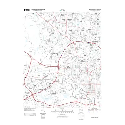
2013 Map of Raleigh West
USGS Topo · Published 2013About this map
Dorton Arena and the Reynolds Coliseum stand as major architectural landmarks in this 2013 survey of western Raleigh. The map documents the city's complex suburban expansion, characterized by a dense network of residential developments such as Hayes Barton, Boylan Heights, and Anderson Heights. These neighborhoods are woven into a landscape defined by significant water bodies, including Lake Johnson in the southwest and Shelley Lake to the north.
Find a feature on this map
114 named features on this map. Tap any name to fly to it.
Don’t see what you’re looking for? This feature index may not catch every label — zoom into the map to look around manually.
Map Details
Editions of this 2013 Raleigh West Map
This is the sole edition of this map. No revisions or reprints were ever made.
Other maps of this area

1943 · Durham South
USGS Topo · 1:62,500

1943 · Raleigh
USGS Topo · 1:62,500

1951 · Raleigh
USGS Topo · 1:62,500

1951 · Durham South
USGS Topo · 1:62,500

1953 · Raleigh
USGS Topo · 1:250,000

1954 · Raleigh
USGS Topo · 1:250,000

1964 · Lake Wheeler
USGS Topo · 1:24,000

1964 · Garner
USGS Topo · 1:24,000

1964 · Garner
USGS Topo · 1:62,500
1967 · Wake Forest
USGS Topo · 1:24,000