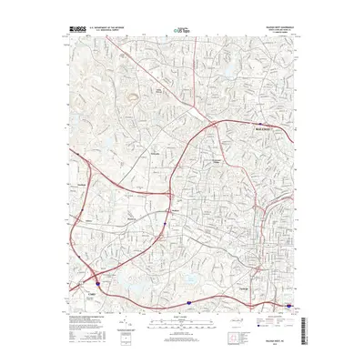
2016 Map of Raleigh West
USGS Topo · Published 2016About this map
Raleigh and its western suburbs show a landscape defined by a mix of historic institutional grounds and modern urban expansion in the mid-2010s. The dense academic core is prominent, featuring the expansive campus of N Carolina State Univ at Raleigh, Meredith Coll, and Shaw Univ near the city center. This concentration of educational landmarks, alongside the historic Oakwood Cem and Mount Hope Cem, anchors the city's eastern edge on this sheet, while the western corridor transitions into residential communities like Method and Glenwood Village.
Find a feature on this map
54 named features on this map. Tap any name to fly to it.
Don’t see what you’re looking for? This feature index may not catch every label — zoom into the map to look around manually.
Map Details
Editions of this 2016 Raleigh West Map
This is the sole edition of this map. No revisions or reprints were ever made.
Other maps of this area

1943 · Durham South
USGS Topo · 1:62,500

1943 · Raleigh
USGS Topo · 1:62,500

1951 · Raleigh
USGS Topo · 1:62,500

1951 · Durham South
USGS Topo · 1:62,500

1953 · Raleigh
USGS Topo · 1:250,000

1954 · Raleigh
USGS Topo · 1:250,000

1964 · Lake Wheeler
USGS Topo · 1:24,000

1964 · Garner
USGS Topo · 1:24,000

1964 · Garner
USGS Topo · 1:62,500
1967 · Wake Forest
USGS Topo · 1:24,000