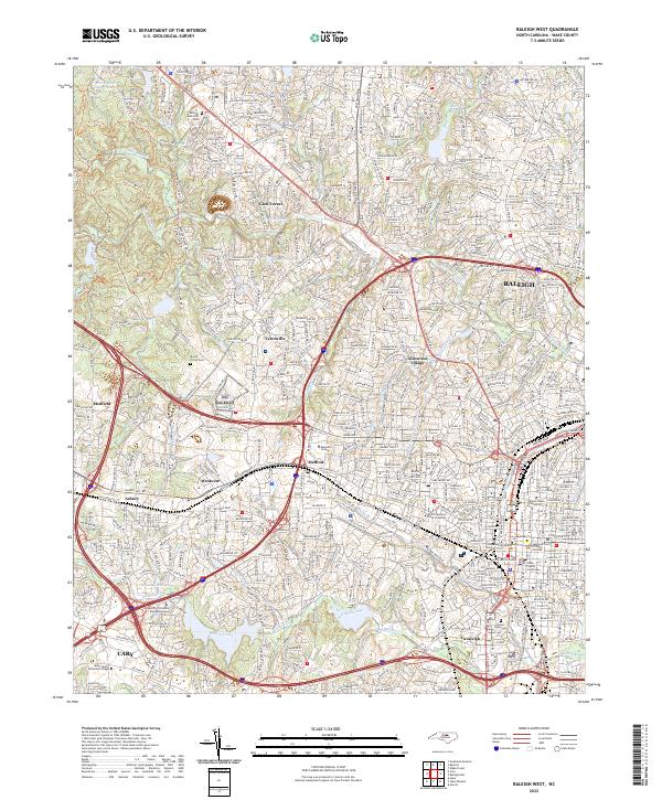
2022 Map of Raleigh West
USGS Topo · Published 2022About this map
The capital city of Raleigh anchors this survey of Wake County, illustrating the urban evolution of the Research Triangle as of 2022. The map details the core of the city, including the Supreme Court of North Carolina and the Wake County Courthouse, while tracing the expansion of its academic institutions. Landmarks like North Carolina State University, Meredith College, and Shaw University are clearly delineated alongside the historic neighborhood of Method.
Find a feature on this map
269 named features on this map. Tap any name to fly to it.
Don’t see what you’re looking for? This feature index may not catch every label — zoom into the map to look around manually.
Map Details
Editions of this 2022 Raleigh West Map
This is the sole edition of this map. No revisions or reprints were ever made.
Other maps of this area

1943 · Durham South
USGS Topo · 1:62,500

1943 · Raleigh
USGS Topo · 1:62,500

1951 · Raleigh
USGS Topo · 1:62,500

1951 · Durham South
USGS Topo · 1:62,500

1953 · Raleigh
USGS Topo · 1:250,000

1954 · Raleigh
USGS Topo · 1:250,000

1964 · Lake Wheeler
USGS Topo · 1:24,000

1964 · Garner
USGS Topo · 1:24,000

1964 · Garner
USGS Topo · 1:62,500
1967 · Wake Forest
USGS Topo · 1:24,000