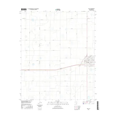
2016 Map of Ralls
USGS Topo · Published 2016About this map
Ralls serves as the primary population center on this High Plains landscape, situated at the intersection of several regional thoroughfares. The town's grid is well-defined by named streets like 17th St and 11th St, with a local Po and a Cem located just to the southwest. Outside the town limits, the terrain is characterized by numerous small depressions and playas typical of the region, interspersed with a dense network of agricultural corridors such as Ranch Rd 1471, Co Rd 144, and Ranch Rd 2236. This 2016 survey illustrates the persistent importance of the section-line road system and rural ranch routes like Ranch Rd 2576 in connecting the scattered farmsteads of Crosby County.
Find a feature on this map
56 named features on this map. Tap any name to fly to it.
Don’t see what you’re looking for? This feature index may not catch every label — zoom into the map to look around manually.
Map Details
Editions of this 2016 Ralls Map
This is the sole edition of this map. No revisions or reprints were ever made.
Other maps of this area

1954 · Lubbock
USGS Topo · 1:250,000

1965 · Acuff
USGS Topo · 1:24,000

1965 · Petersburg
USGS Topo · 1:24,000

1965 · Lorenzo
USGS Topo · 1:24,000

1965 · Cone
USGS Topo · 1:24,000

1965 · Floydada SE
USGS Topo · 1:24,000

1967 · Ralls SE
USGS Topo · 1:24,000

1967 · Ralls NE
USGS Topo · 1:24,000

1967 · Ralls
USGS Topo · 1:24,000

1967 · Savage
USGS Topo · 1:24,000