2022 Map of Ralls
USGS Topo · Published 2022About this map
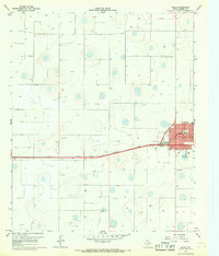
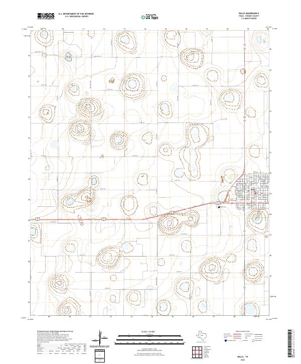
Ralls sits at the intersection of agricultural transport and civic planning in this high plains landscape of Crosby County. The town layout is clearly defined by a grid of numbered streets and named thoroughfares such as Main Ave and Tilford Ave, reflecting a settled community structure. Just west of the town center, the Ralls Cem serves as a significant landmark for genealogists and local historians tracking the area's residents. The surrounding terrain is heavily influenced by a network of rural roads, including Ranch Rd 1471 and Ranch Rd 2236, which facilitate the movement of goods through this productive region. These routes connect various family-held lands and smaller intersections, illustrating the long-standing importance of road infrastructure in the local economy.
Find a feature on this map
38 named features on this map. Tap any name to fly to it.
Don’t see what you’re looking for? This feature index may not catch every label — zoom into the map to look around manually.
Map Details
Editions of this 2022 Ralls Map
This is the sole edition of this map. No revisions or reprints were ever made.