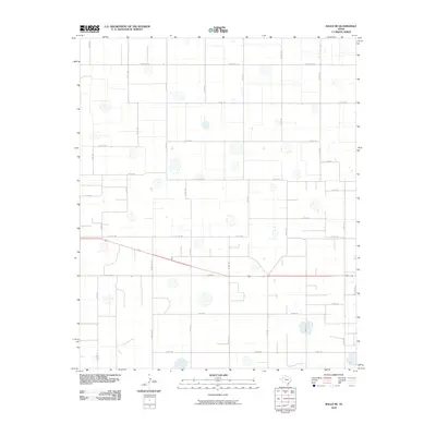
2010 Map of Ralls NE
USGS Topo · Published 2010About this map
Agricultural lands and isolated playa lakes define this portion of the Texas High Plains during the early 21st century. The landscape is organized by a rigid grid of rural thoroughfares, such as Ranch Rd 1471 and Ranch Rd 1831, which facilitate the transport of crops across Crosby County. Numerous ephemeral water bodies are scattered throughout the quadrangle, reflecting the region's characteristic internal drainage patterns and reliance on seasonal rainfall. State and local routes, including Co Rd 161 and Co Rd 185, provide access to remote farmsteads and ranching operations. This survey illustrates the persistent geometry of West Texas land division, where the vast majority of the terrain is dedicated to large-scale cultivation and the maintenance of a sparse but essential rural road network.
Find a feature on this map
26 named features on this map. Tap any name to fly to it.
Don’t see what you’re looking for? This feature index may not catch every label — zoom into the map to look around manually.
Map Details
Editions of this 2010 Ralls NE Map
This is the sole edition of this map. No revisions or reprints were ever made.
Other maps of this area

1954 · Lubbock
USGS Topo · 1:250,000

1965 · Cone
USGS Topo · 1:24,000

1965 · Floydada SE
USGS Topo · 1:24,000

1966 · Crosbyton
USGS Topo · 1:24,000

1966 · Mount Blanco
USGS Topo · 1:24,000

1966 · Collett Springs
USGS Topo · 1:24,000

1967 · Ralls SE
USGS Topo · 1:24,000

1967 · Ralls NE
USGS Topo · 1:24,000

1967 · Ralls
USGS Topo · 1:24,000

1967 · Savage
USGS Topo · 1:24,000