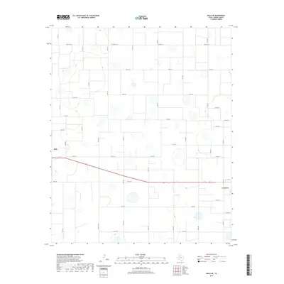
2019 Map of Ralls NE
USGS Topo · Published 2019About this map
Ralls and Crosbyton anchor the edges of this high plains landscape in Crosby County, where a dense grid of rural corridors defines the local geography. The area's transition into the 21st century is marked by a highly organized section line road system, including significant local routes like Co Rd 168 and Co Rd 144. The presence of Ranch Rd 1471 across the northern reaches and Ranch Rd 1831 to the south illustrates the continued importance of ranching infrastructure in this part of West Texas. This survey by the U.S. Geological Survey details a predominantly agricultural and ranching terrain, where small topographic depressions and wetlands are interspersed among the rectangular fields and pastures. The proximity of the two primary settlements, connected by a network of secondary roads such as Co Rd 162, suggests a landscape built on the logistical needs of large-scale land management.
Find a feature on this map
32 named features on this map. Tap any name to fly to it.
Don’t see what you’re looking for? This feature index may not catch every label — zoom into the map to look around manually.
Map Details
Editions of this 2019 Ralls NE Map
This is the sole edition of this map. No revisions or reprints were ever made.
Other maps of this area

1954 · Lubbock
USGS Topo · 1:250,000

1965 · Cone
USGS Topo · 1:24,000

1965 · Floydada SE
USGS Topo · 1:24,000

1966 · Crosbyton
USGS Topo · 1:24,000

1966 · Mount Blanco
USGS Topo · 1:24,000

1966 · Collett Springs
USGS Topo · 1:24,000

1967 · Ralls SE
USGS Topo · 1:24,000

1967 · Ralls NE
USGS Topo · 1:24,000

1967 · Ralls
USGS Topo · 1:24,000

1967 · Savage
USGS Topo · 1:24,000