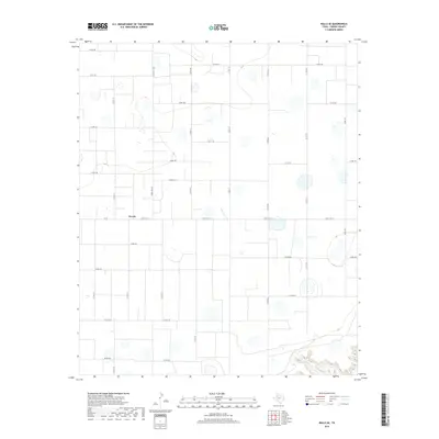
2019 Map of Ralls SE
USGS Topo · Published 2019About this map
Owens serves as the central hub of this agricultural landscape in Crosby County, where a strictly organized grid of rural roads defines the terrain of the Llano Estacado. The settlement is situated at the junction of Fm 40 and Ranch Rd 1831, surrounded by a network of county roads including Co RD 192 and Co RD 206. This 2019 survey illustrates the persistent geometry of High Plains farming, where nearly every section is accessible by a named route. In the southeastern corner, the flat expanse gives way to the more complex topography of the McDonald Cr drainage, representing the beginning of the break-in-the-plains where erosion has carved into the Caprock. This contrast between the engineered road grid and the natural winding path of the creek highlights the edge of the plateau's transition into the canyon lands.
Find a feature on this map
28 named features on this map. Tap any name to fly to it.
Don’t see what you’re looking for? This feature index may not catch every label — zoom into the map to look around manually.
Map Details
Editions of this 2019 Ralls SE Map
This is the sole edition of this map. No revisions or reprints were ever made.
Other maps of this area

1954 · Lubbock
USGS Topo · 1:250,000

1966 · Cap Rock
USGS Topo · 1:24,000

1966 · Crosbyton
USGS Topo · 1:24,000

1966 · Kalgary
USGS Topo · 1:24,000

1966 · Collett Springs
USGS Topo · 1:24,000

1966 · Canyon Valley
USGS Topo · 1:24,000

1967 · Ralls SE
USGS Topo · 1:24,000

1967 · Ralls NE
USGS Topo · 1:24,000

1967 · Ralls
USGS Topo · 1:24,000

1967 · Savage
USGS Topo · 1:24,000