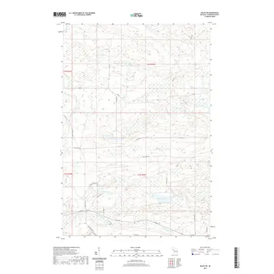
2019 Map of Ralph SW
USGS Topo · Published 2019About this map
The Sturgeon River network dominates this part of Dickinson County, with the W Br Sturgeon River, N Br Sturgeon River, and E Br Sturgeon River all converging within the township lines. The landscape is a complex of waterways and wetlands, including Solberg Lake and Sixmile Lake, shaped by the Upper Peninsula’s glacial geography. The road system reflects the region's industrial and recreational history, anchored by Groveland Mine Rd in the southwest and Wells Grade Rd cutting through the center. Numerous secondary routes like Seasonal Rd and Lerza Rd suggest a wilderness managed for timber and iron, while the presence of Solberg Lake Cr and Sixmile Cr indicates a well-watered timberland. This 2019 survey captures the modern configuration of Felch Township's backcountry and its enduring connection to the mining and forestry sectors.
Find a feature on this map
29 named features on this map. Tap any name to fly to it.
Don’t see what you’re looking for? This feature index may not catch every label — zoom into the map to look around manually.
Map Details
Editions of this 2019 Ralph SW Map
This is the sole edition of this map. No revisions or reprints were ever made.
Other maps of this area

1899 · Sagola
USGS Topo · 1:62,500

1939 · Iron Mountain
USGS Topo · 1:48,000

1941 · Iron Mountain
USGS Topo · 1:48,000

1947 · Iron Mountain
USGS Topo · 1:48,000

1954 · Iron Mountain
USGS Topo · 1:250,000

1954 · Escanaba
USGS Topo · 1:250,000

1955 · Ralph NW
USGS Topo · 1:24,000

1955 · Ralph NE
USGS Topo · 1:24,000

1955 · Norway
USGS Topo · 1:62,500
1955 · Randville
USGS Topo · 1:24,000