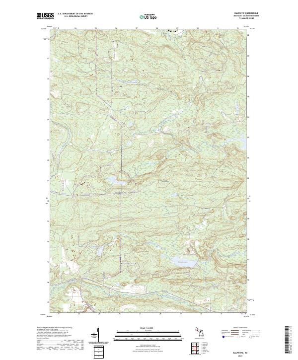
2023 Map of Ralph SW
USGS Topo · Published 2023About this map
The Sturgeon River watershed dominates this landscape in Dickinson County, where the East Branch, West Branch, and North Branch converge. The terrain is defined by a dense network of forest roads and trails, including Wells Grade Rd and Seasonal Rd, which navigate the wetlands and lowlands surrounding Sixmile Lake and Solberg Lake. Historically significant routes like Groveland Mine Rd hint at the industrial heritage of the Upper Peninsula, while named pathways such as Up16 Trl and Up5 Trl suggest a modern focus on backcountry access. The northern reaches of the area are drained by the Ford River, illustrating the complex hydrology of this part of Michigan. The absence of concentrated settlements emphasizes the remote, natural character of the township boundaries like t43n r29w and t42n r30w.
Find a feature on this map
31 named features on this map. Tap any name to fly to it.
Don’t see what you’re looking for? This feature index may not catch every label — zoom into the map to look around manually.
Map Details
Editions of this 2023 Ralph SW Map
This is the sole edition of this map. No revisions or reprints were ever made.
Other maps of this area

1899 · Sagola
USGS Topo · 1:62,500

1939 · Iron Mountain
USGS Topo · 1:48,000

1941 · Iron Mountain
USGS Topo · 1:48,000

1947 · Iron Mountain
USGS Topo · 1:48,000

1954 · Iron Mountain
USGS Topo · 1:250,000

1954 · Escanaba
USGS Topo · 1:250,000

1955 · Ralph NW
USGS Topo · 1:24,000

1955 · Ralph NE
USGS Topo · 1:24,000

1955 · Norway
USGS Topo · 1:62,500
1955 · Randville
USGS Topo · 1:24,000