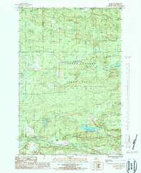
1986 Map of Ralph SW
USGS Topo · Published 1986About this map
Copper Country State Forest dominates this section of the Upper Peninsula, showing a landscape defined by timber and the extensive watershed of the Ford River and West Branch Sturgeon River. The map reveals the industrial footprint of the region's extraction history, featuring a Mine and Mine Dump alongside a Gaging Station used for monitoring these critical waterways. Small settlements like Felch anchor the woodland terrain, while recreational and natural landmarks such as Sixmile Lake, which includes a Boat Ramp, and Solberg Lake illustrate the area's transition into a managed natural resource. The presence of a Transmission Line and Pipeline cutting through the forest reflects the utility infrastructure required to support the remote mining and logging operations of Dickinson County during the mid-1980s.
Find a feature on this map
18 named features on this map. Tap any name to fly to it.
Don’t see what you’re looking for? This feature index may not catch every label — zoom into the map to look around manually.
Map Details
Editions of this 1986 Ralph SW Map
This is the sole edition of this map. No revisions or reprints were ever made.
Other maps of this area

1899 · Sagola
USGS Topo · 1:62,500

1939 · Iron Mountain
USGS Topo · 1:48,000

1941 · Iron Mountain
USGS Topo · 1:48,000

1947 · Iron Mountain
USGS Topo · 1:48,000

1954 · Iron Mountain
USGS Topo · 1:250,000

1954 · Escanaba
USGS Topo · 1:250,000

1955 · Ralph NW
USGS Topo · 1:24,000

1955 · Ralph NE
USGS Topo · 1:24,000

1955 · Norway
USGS Topo · 1:62,500
1955 · Randville
USGS Topo · 1:24,000