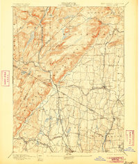
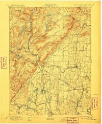
1893 Map of Ramapo
USGS Topo · Published 1905About this map
The Ramapo Mountains dominate the western horizon of this late nineteenth-century landscape, a terrain of sharp ridges and isolated ponds like Tuxedo Lake and Sheppard Pond. This area represents a critical corridor for the New York Lake Erie and Western Railroad, which follows the narrow valley carved by the Ramapo River. Along this transit artery, settlements such as Sloatsburg, Ramapo, and Suffern prosper at the base of the highlands.
Find a feature on this map
89 named features on this map. Tap any name to fly to it.
Don’t see what you’re looking for? This feature index may not catch every label — zoom into the map to look around manually.
Map Details
Editions of this 1893 Ramapo Map
6 editions found

Other maps of this area

1888 · Morristown
USGS Topo · 1:62,500

1888 · Paterson
USGS Topo · 1:62,500

1891 · Greenwood Lake
USGS Topo · 1:62,500

1891 · Ramapo
USGS Topo · 1:62,500

1891 · Harlem
USGS Topo · 1:62,500

1892 · West Point
USGS Topo · 1:62,500

1892 · Paterson
USGS Topo · 1:62,500

1892 · Tarrytown
USGS Topo · 1:62,500

1893 · Greenwood Lake
USGS Topo · 1:62,500

1893 · Tarrytown
USGS Topo · 1:62,500