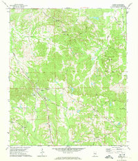
1971 Map of Ramer
USGS Topo · Published 1974About this map
Ramer serves as the focal point of this Montgomery County landscape, situated at the intersection of several local thoroughfares and the Seaboard Coast Line railroad. The settlement is defined by its community infrastructure, featuring the County High Sch, Dunbar Sch, and the Weeping Mary Ch. Beyond the main village, the geography is dotted with rural hamlets such as Dublin and Friendship, each anchored by local congregations like Hills Chapel and Friendship Ch.
Find a feature on this map
51 named features on this map. Tap any name to fly to it.
Don’t see what you’re looking for? This feature index may not catch every label — zoom into the map to look around manually.
Map Details
Editions of this 1971 Ramer Map
2 editions found
Other maps of this area

1953 · Montgomery
USGS Topo · 1:250,000

1953 · Andalusia
USGS Topo · 1:250,000

1956 · Montgomery
USGS Topo · 1:250,000

1957 · Montgomery
USGS Topo · 1:250,000

1957 · Andalusia
USGS Topo · 1:250,000

1957 · Letohatchee
USGS Topo · 1:62,500
1968 · Ansley
USGS Topo · 1:24,000

1968 · Grady
USGS Topo · 1:24,000

1971 · Davis Crossroads
USGS Topo · 1:24,000
1971 · Teasleys Mill
USGS Topo · 1:24,000