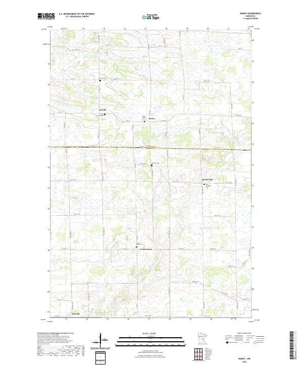
2022 Map of Ramey
USGS Topo · Published 2022About this map
Morrill and Ramey anchor the northern landscape of this Central Minnesota region, where the terrain is defined by the winding course of the Elk River. The map illustrates a rural settlement pattern characteristic of the area's agricultural history, with small clusters of development like Brennyville and North Benton situated along a grid of county roads. The high density of community markers, particularly Saint Josephs Cem and the Polish Church Cem, reflects the deep-rooted cultural and religious heritage of the immigrant families who farmed this land. Further south, the Saint Francis River cuts through the southeastern corner, while the small community of Jakeville sits near the southern boundary. This survey offers a detailed look at the many cemeteries and township roads, such as Twp Rd 313, that served these pioneer-era farming communities into the modern day.
Find a feature on this map
41 named features on this map. Tap any name to fly to it.
Don’t see what you’re looking for? This feature index may not catch every label — zoom into the map to look around manually.
Map Details
Editions of this 2022 Ramey Map
This is the sole edition of this map. No revisions or reprints were ever made.
Other maps of this area

1948 · Pierz
USGS Topo · 1:62,500

1950 · Pierz
USGS Topo · 1:62,500

1950 · St. Cloud
USGS Topo · 1:62,500

1953 · Saint Cloud
USGS Topo · 1:250,000

1953 · Stillwater
USGS Topo · 1:250,000

1955 · Stillwater
USGS Topo · 1:250,000

1957 · Saint Cloud
USGS Topo · 1:250,000

1958 · Stillwater
USGS Topo · 1:250,000

1958 · Saint Cloud
USGS Topo · 1:250,000

1965 · Stillwater
USGS Topo · 1:250,000