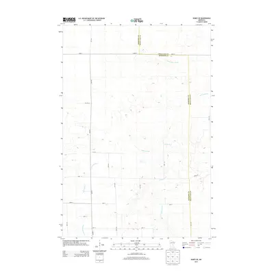
2013 Map of Ramey NE
USGS Topo · Published 2013About this map
The W Br Rum River and Tibbetts Brook define the hydrologic character of this rural landscape where Morrison and Mille Lacs counties meet. This 2013 survey illustrates a highly structured grid of section-line roads, including Sage Rd, Merlin Rd, and numerically named avenues such as 400th Ave and 430th Ave. These corridors serve a scattered agricultural community, with the W Br Rum River snaking through the southwestern corner and S Fork Bradbury Brook crossing the northern boundary. Smaller drainages like Burnt Lane Brook and local landmarks such as Twp Hwy 632 provide specific reference points for those researching family land holdings or the mid-century evolution of local township infrastructure in central Minnesota.
Find a feature on this map
23 named features on this map. Tap any name to fly to it.
Don’t see what you’re looking for? This feature index may not catch every label — zoom into the map to look around manually.
Map Details
Editions of this 2013 Ramey NE Map
This is the sole edition of this map. No revisions or reprints were ever made.
Other maps of this area

1953 · Duluth
USGS Topo · 1:250,000

1953 · Stillwater
USGS Topo · 1:250,000

1955 · Stillwater
USGS Topo · 1:250,000

1958 · Stillwater
USGS Topo · 1:250,000

1958 · Duluth
USGS Topo · 1:250,000

1965 · Stillwater
USGS Topo · 1:250,000

1968 · Ramey NE
USGS Topo · 1:24,000

1968 · Onamia
USGS Topo · 1:24,000
1968 · Ramey NW
USGS Topo · 1:24,000

1968 · Rum River
USGS Topo · 1:24,000