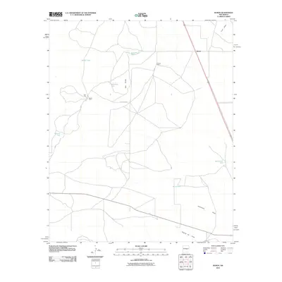
2010 Map of Ramon
USGS Topo · Published 2010About this map
Ramon serves as the central focal point for this Lincoln County high-desert landscape, where ranching and water management define the settlement patterns. The map highlights the reliance on man-made water features such as Bethell Tank, Red Bluff Tank, and Burnt Tank to sustain life and livestock in an arid environment marked by Red Bluffs. Significant family-held properties like Simpson Ranch and Merritt Ranch are connected by a network of local roads including County RD-b048. The local geography is etched by seasonal watercourses like Loco Draw, Automobile Draw, and Dipping Vat Draw, the latter suggesting the historical importance of sheep or cattle ranching in the region. Notable landmarks such as the Mile High point and the curiously named Automobile Lake provide specific waypoints for researchers studying the land use and topography of this New Mexico territory.
Find a feature on this map
16 named features on this map. Tap any name to fly to it.
Don’t see what you’re looking for? This feature index may not catch every label — zoom into the map to look around manually.
Map Details
Editions of this 2010 Ramon Map
This is the sole edition of this map. No revisions or reprints were ever made.
Other maps of this area

1954 · Fort Sumner
USGS Topo · 1:250,000

1958 · Fort Sumner
USGS Topo · 1:250,000

1967 · Wire Lake
USGS Topo · 1:24,000

1967 · Ramon
USGS Topo · 1:24,000

1967 · Ramon SW
USGS Topo · 1:24,000

1967 · Wright Ranch
USGS Topo · 1:24,000

1979 · Fort Sumner
USGS Topo · 1:100,000

1980 · Corona
USGS Topo · 1:100,000

1981 · Loco Draw
USGS Topo · 1:24,000

1981 · Cowboy Mesa NE
USGS Topo · 1:24,000