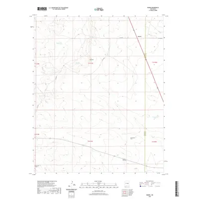
2020 Map of Ramon
USGS Topo · Published 2020About this map
Ramon sits along the 285 highway in this high-plains landscape of the New Mexico interior. The area is defined by its water management infrastructure and drainage patterns, which are vital in this arid environment. Ranching operations are evidenced by numerous livestock tanks, including Schoolhouse Tank, Bethell Tank, and Burnt Tank, which provide essential resources for the local economy. The terrain is marked by distinctive geological and hydrological features such as Red Bluffs and the substantial Fifteenmile Arroyo. The network of ephemeral drainages, specifically Automobile Draw and Dipping Vat Draw, suggests the seasonal flow of water that shapes the land across the boundary between Lincoln and De Baca counties. The presence of Automobile Lake in the eastern section provides a specific point of interest for understanding local water collection and land use during this era.
Find a feature on this map
21 named features on this map. Tap any name to fly to it.
Don’t see what you’re looking for? This feature index may not catch every label — zoom into the map to look around manually.
Map Details
Editions of this 2020 Ramon Map
This is the sole edition of this map. No revisions or reprints were ever made.
Other maps of this area

1954 · Fort Sumner
USGS Topo · 1:250,000

1958 · Fort Sumner
USGS Topo · 1:250,000

1967 · Wire Lake
USGS Topo · 1:24,000

1967 · Ramon
USGS Topo · 1:24,000

1967 · Ramon SW
USGS Topo · 1:24,000

1967 · Wright Ranch
USGS Topo · 1:24,000

1979 · Fort Sumner
USGS Topo · 1:100,000

1980 · Corona
USGS Topo · 1:100,000

1981 · Loco Draw
USGS Topo · 1:24,000

1981 · Cowboy Mesa NE
USGS Topo · 1:24,000