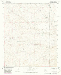
1967 Map of Ramon SW
USGS Topo · Published 1982About this map
Fifteenmile Arroyo and its drainage network of seasonal draws define the landscape of this high plains ranching country at the intersection of Lincoln, De Baca, and Chaves counties. The mapping reflects a late 1960s livestock economy, centered on isolated facilities like Shearing Shed Camp and West Camp. The scarcity of surface water is evident in the reliance on man-made catchments and deep wells, including Railroad Tank, Big Red Tank, and Shearing Shed Well.
Find a feature on this map
31 named features on this map. Tap any name to fly to it.
Don’t see what you’re looking for? This feature index may not catch every label — zoom into the map to look around manually.
Map Details
Editions of this 1967 Ramon SW Map
2 editions found
Other maps of this area

1954 · Fort Sumner
USGS Topo · 1:250,000

1955 · Roswell
USGS Topo · 1:250,000

1958 · Fort Sumner
USGS Topo · 1:250,000

1958 · Roswell
USGS Topo · 1:250,000

1962 · Roswell
USGS Topo · 1:250,000

1967 · Wire Lake
USGS Topo · 1:24,000

1967 · Round Mountain
USGS Topo · 1:24,000

1967 · Chivata Canyon
USGS Topo · 1:24,000

1967 · Ramon
USGS Topo · 1:24,000

1967 · Ramon SW
USGS Topo · 1:24,000