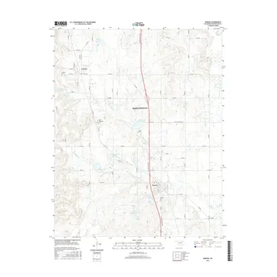
2016 Map of Ramona
USGS Topo · Published 2016About this map
Bartlesville and the southern reaches of Washington County are defined here by a series of flood-control reservoirs and rural road networks. The settlements of Ramona and Ochelata serve as central hubs for the surrounding prairie and farmland, with SE Washington Blvd acting as the primary north-south corridor. The landscape is marked by unique hydrological management, featuring a numeric system of reservoirs including Double Creek Site 1 Reservoir, Double Creek Site 2 Reservoir, and several others that dot the drainage of S Fork Double Cr. Local history is anchored by the Ochelata Cem, Ceasar Cem, and Ramona Cem, while the distinct Twin Mounds provides a natural landmark amidst the agricultural grid. To the northeast, the Caney River cuts across the corner of the quadrangle, contrasting with the smaller bodies of water like Lake Todd and Ochelata Lake.
Find a feature on this map
59 named features on this map. Tap any name to fly to it.
Don’t see what you’re looking for? This feature index may not catch every label — zoom into the map to look around manually.
Map Details
Editions of this 2016 Ramona Map
This is the sole edition of this map. No revisions or reprints were ever made.
Other maps of this area

1901 · Claremore
USGS Topo · 1:125,000

1901 · Nowata
USGS Topo · 1:125,000

1909 · Pawhuska
USGS Topo · 1:125,000

1910 · Pawhuska
USGS Topo · 1:125,000

1912 · Hominy
USGS Topo · 1:125,000

1914 · Nowata
USGS Topo · 1:125,000

1914 · Claremore
USGS Topo · 1:125,000

1915 · Hominy
USGS Topo · 1:125,000

1916 · Claremore
USGS Topo · 1:125,000

1954 · Tulsa
USGS Topo · 1:250,000