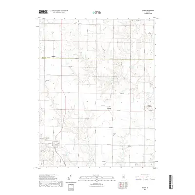
2021 Map of Ramsey
USGS Topo · Published 2021About this map
Ramsey serves as the primary hub of this landscape, situated at the intersection of a grid of rural routes and local waterways. The town's layout, centered on W Main St and E 4th St, reflects a classic Midwestern rail-and-road orientation, surrounded by family-named burial sites such as Saint Josephs Cem and Hayes Cem. The drainage patterns of Ash Cr and Bolt Cr carve through the prairie, defining the placement of outlying communities like Dressor and Hanson.
Find a feature on this map
56 named features on this map. Tap any name to fly to it.
Don’t see what you’re looking for? This feature index may not catch every label — zoom into the map to look around manually.
Map Details
Editions of this 2021 Ramsey Map
This is the sole edition of this map. No revisions or reprints were ever made.
Other maps of this area

1941 · St. Elmo
USGS Topo · 1:62,500

1942 · Shelbyville
USGS Topo · 1:62,500

1944 · Ramsey
USGS Topo · 1:62,500

1945 · St. Elmo
USGS Topo · 1:62,500

1946 · Shelbyville
USGS Topo · 1:62,500

1946 · Ramsey
USGS Topo · 1:62,500

1947 · Pana
USGS Topo · 1:62,500

1949 · Pana
USGS Topo · 1:62,500

1958 · Decatur
USGS Topo · 1:250,000

1961 · Decatur
USGS Topo · 1:250,000