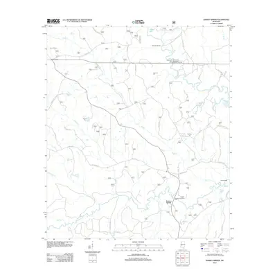
2012 Map of Ramsey Springs
USGS Topo · Published 2012About this map
Ramsey Springs and the rural crossroads of Rosette anchor this survey of the Mississippi piney woods, where a complex network of waterways defines the landscape. The region is heavily marked by the winding courses of Black Creek and Bluff Cr, which are joined by numerous tributaries including Cypress Cr, Mill Cr, and Red Cr. These waters provided essential transport and resources for early residents, as evidenced by landmarks like Moore Crossing, Alexander Bridge, and the Black Creek Boat Ramp.
Find a feature on this map
56 named features on this map. Tap any name to fly to it.
Don’t see what you’re looking for? This feature index may not catch every label — zoom into the map to look around manually.
Map Details
Editions of this 2012 Ramsey Springs Map
This is the sole edition of this map. No revisions or reprints were ever made.
Other maps of this area

1947 · Wiggins
USGS Topo · 1:62,500

1947 · Benndale
USGS Topo · 1:62,500

1949 · Wiggins
USGS Topo · 1:62,500

1949 · Benndale
USGS Topo · 1:62,500

1953 · Mobile
USGS Topo · 1:250,000

1954 · Vestry
USGS Topo · 1:62,500

1954 · McHenry
USGS Topo · 1:62,500

1957 · Mobile
USGS Topo · 1:250,000

1960 · Mobile
USGS Topo · 1:250,000

1963 · Mobile
USGS Topo · 1:250,000