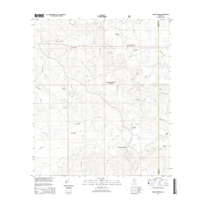
2015 Map of Ramsey Springs
USGS Topo · Published 2015About this map
Desoto National Forest encompasses much of this landscape, where the meandering paths of Black Creek and Red Creek define the local topography. The settlement of Ramsey Springs sits near the confluence of several smaller tributaries, including Little Cr and Abbot Br, reflecting a long-standing relationship between local residents and the area's complex drainage systems. The map preserves the locations of numerous family and community landmarks, such as Moore Cem, Alexander Cem, and Wittington Cem, which offer significant value for genealogical research.
Find a feature on this map
52 named features on this map. Tap any name to fly to it.
Don’t see what you’re looking for? This feature index may not catch every label — zoom into the map to look around manually.
Map Details
Editions of this 2015 Ramsey Springs Map
This is the sole edition of this map. No revisions or reprints were ever made.
Other maps of this area

1947 · Wiggins
USGS Topo · 1:62,500

1947 · Benndale
USGS Topo · 1:62,500

1949 · Wiggins
USGS Topo · 1:62,500

1949 · Benndale
USGS Topo · 1:62,500

1953 · Mobile
USGS Topo · 1:250,000

1954 · Vestry
USGS Topo · 1:62,500

1954 · McHenry
USGS Topo · 1:62,500

1957 · Mobile
USGS Topo · 1:250,000

1960 · Mobile
USGS Topo · 1:250,000

1963 · Mobile
USGS Topo · 1:250,000