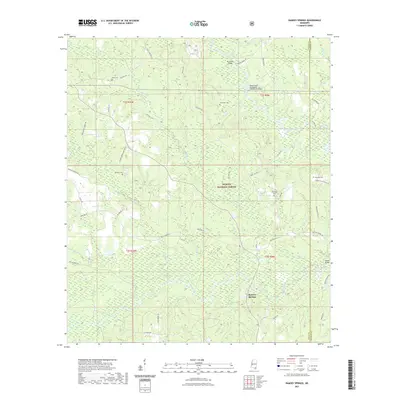
2021 Map of Ramsey Springs
USGS Topo · Published 2021About this map
De Soto National Forest blankets much of this landscape in southern Mississippi, where the dense woodlands are intersected by the winding paths of Black Creek and Red Creek. The settlement of Ramsey Springs sits near the southern boundary, surrounded by a network of rural roads that hint at the area's timber and transit history. For genealogists and local historians, the map is a detailed record of family legacies, marking several burial sites including Alexander Cem, Hickman Cem, Moore Cem, and the Wittington Cem. Physical infrastructure is highlighted by crossings such as the Black Creek Mississippi Highway 26 Bridge and Parker Bridge, while namesake routes like Broome School Rd and Hickman Bond Cemetery Rd preserve the locations of former community landmarks. The drainage patterns of numerous tributaries, such as Poplar Br and Double Br, define the low-lying terrain of the Stone and George County border.
Find a feature on this map
61 named features on this map. Tap any name to fly to it.
Don’t see what you’re looking for? This feature index may not catch every label — zoom into the map to look around manually.
Map Details
Editions of this 2021 Ramsey Springs Map
This is the sole edition of this map. No revisions or reprints were ever made.
Other maps of this area

1947 · Wiggins
USGS Topo · 1:62,500

1947 · Benndale
USGS Topo · 1:62,500

1949 · Wiggins
USGS Topo · 1:62,500

1949 · Benndale
USGS Topo · 1:62,500

1953 · Mobile
USGS Topo · 1:250,000

1954 · Vestry
USGS Topo · 1:62,500

1954 · McHenry
USGS Topo · 1:62,500

1957 · Mobile
USGS Topo · 1:250,000

1960 · Mobile
USGS Topo · 1:250,000

1963 · Mobile
USGS Topo · 1:250,000