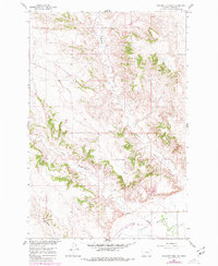
1960 Map of Rancher Cemetery
USGS Topo · Published 1980About this map
Pease Bottom dominates the southeastern corner of this landscape, where the alluvial terrain meets the winding course of the Rancher Ditch. This 1960 survey, updated with photo revisions in 1980, reveals a dry Montana landscape defined by the drainage networks of Muggins Creek and Alkali Creek. The topography is characterized by intricate coulees and breaks that separate these watercourses, illustrating the geological forces shaping Treasure County. For genealogists and local historians, the Rancher Cemetery serves as a primary point of interest, situated near the intersection of the upland draws and the irrigation-fed flats. The presence of a Pit and various water-management features like the ditch system reflects the area's dual reliance on natural drainage and engineered irrigation for ranching and agriculture.
Find a feature on this map
7 named features on this map. Tap any name to fly to it.
Don’t see what you’re looking for? This feature index may not catch every label — zoom into the map to look around manually.
Map Details
Editions of this 1960 Rancher Cemetery Map
2 editions found
Other maps of this area

1954 · Forsyth
USGS Topo · 1:250,000

1957 · Forsyth
USGS Topo · 1:250,000

1958 · Forsyth
USGS Topo · 1:250,000

1960 · Bighorn
USGS Topo · 1:24,000

1960 · Steie Ranch
USGS Topo · 1:24,000

1960 · Custer
USGS Topo · 1:24,000

1960 · Myers
USGS Topo · 1:24,000

1960 · Rancher Cemetery
USGS Topo · 1:24,000

1960 · Eldering Ranch
USGS Topo · 1:24,000

1960 · Mc Konkey Creek
USGS Topo · 1:24,000