2021 Map of Ranchester
USGS Topo · Published 2021About this map
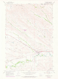
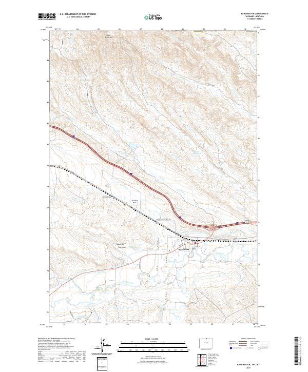
The Ranchester townsite sits at the confluence of several vital water management systems in northern Sheridan County, illustrating the high-plains reliance on irrigation. The landscape is defined by an intricate network of man-made waterways, including the Mikado Ditch, Hanover Ditch, York Ditch, and W Wolf Ditch, which redirect water from the Tongue River and its tributaries to support the surrounding valley. To the north, the foothills of the Wolf Mountains rise above a series of named drainages such as Jack Bill Draw and Gwinn Draw, while the presence of Mates Reservoir and the S Side Ditch highlights the coordinated effort to manage seasonal runoff. This 2021 survey details the street grid of the town, featuring Dayton St, Hardin St, and Halbert St, as well as rural connections like Slater Creek Rd and the prominent Ranchester-Five Mile Rd.
Find a feature on this map
51 named features on this map. Tap any name to fly to it.
Don’t see what you’re looking for? This feature index may not catch every label — zoom into the map to look around manually.
Map Details
Editions of this 2021 Ranchester Map
This is the sole edition of this map. No revisions or reprints were ever made.