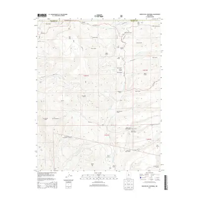
2013 Map of Rancho del Chaparral
USGS Topo · Published 2013About this map
Sierra Nacimiento dominates the southwestern quadrant of this study, where the high elevations of the Santa Fe National Forest give way to a complex network of canyons and mesas. The Rio de las Vacas serves as a primary drainage for the area, joined by numerous tributaries such as Rito Peñas Negras and American Cr. Human activity is concentrated along these watercourses and the high ground of Blue Bird Mesa and Rock Creek Mesa. The map documents established sites like Rancho del Chaparral and the APS Camp, which are connected by a system of forest roads including State Hwy 126 and Wolf Canyon Rd. Notable for its many named canyons—from Wolf Canyon to Telephone Canyon—the landscape is dotted with vital water sources such as Horseshoe Spring and Redtop Spring.
Find a feature on this map
55 named features on this map. Tap any name to fly to it.
Don’t see what you’re looking for? This feature index may not catch every label — zoom into the map to look around manually.
Map Details
Editions of this 2013 Rancho del Chaparral Map
This is the sole edition of this map. No revisions or reprints were ever made.
Other maps of this area

1890 · Jemes
USGS Topo · 1:125,000

1892 · Jemes
USGS Topo · 1:125,000

1909 · Gallina
USGS Topo · 1:125,000

1937 · Jemez Springs
USGS Topo · 1:48,000

1939 · La Ventana
USGS Topo · 1:62,500

1940 · Cuba
USGS Topo · 1:62,500

1943 · Cuba
USGS Topo · 1:62,500

1943 · La Ventana
USGS Topo · 1:62,500

1944 · Jemez Springs
USGS Topo · 1:62,500

1952 · Jemez Springs
USGS Topo · 1:62,500