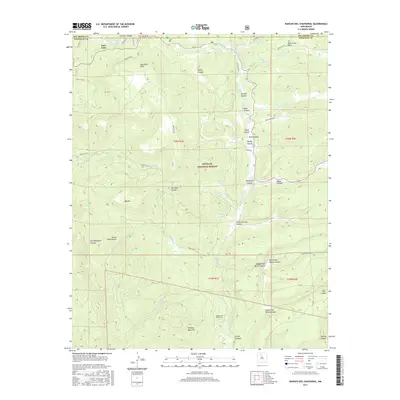
2017 Map of Rancho del Chaparral
USGS Topo · Published 2017About this map
Santa Fe National Forest encompasses this high-elevation landscape, where the Rio de las Vacas and its tributaries carve a network of deep canyons and mesas. The map documents the northern reaches of the Sierra Nacimiento range, including prominent features like Blue Bird Mesa and Rock Creek Mesa. The presence of Rancho del Chaparral at the base of Smokey Bear Hill suggests the localized ranching history of the region. Water remains a defining element of this terrain, with numerous named sources such as Vacas Spring, Barley Spring, and Redtop Spring feeding into the drainage systems. The map traces a complex system of forest roads, including Old Hwy 126 and Forest Rd 20, which provide the primary access through the steep drainages like San Pablo Canyon and Telephone Canyon.
Find a feature on this map
56 named features on this map. Tap any name to fly to it.
Don’t see what you’re looking for? This feature index may not catch every label — zoom into the map to look around manually.
Map Details
Editions of this 2017 Rancho del Chaparral Map
This is the sole edition of this map. No revisions or reprints were ever made.
Other maps of this area

1890 · Jemes
USGS Topo · 1:125,000

1892 · Jemes
USGS Topo · 1:125,000

1909 · Gallina
USGS Topo · 1:125,000

1937 · Jemez Springs
USGS Topo · 1:48,000

1939 · La Ventana
USGS Topo · 1:62,500

1940 · Cuba
USGS Topo · 1:62,500

1943 · Cuba
USGS Topo · 1:62,500

1943 · La Ventana
USGS Topo · 1:62,500

1944 · Jemez Springs
USGS Topo · 1:62,500

1952 · Jemez Springs
USGS Topo · 1:62,500