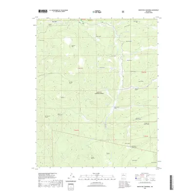
2020 Map of Rancho del Chaparral
USGS Topo · Published 2020About this map
Santa Fe National Forest encompasses much of this high-elevation landscape, where deep canyons and prominent mesas dictate the movement of water and travelers alike. The Sierra Nacimiento range dominates the southwest, while the Rio de las Vacas carves a significant path through the center of the sheet. Modern structures at Rancho del Chaparral sit alongside historic land management markers like School Section Canyon, indicating the transition from traditional ranching and timber interest to more modern recreational and organizational use. Named landmarks like Smokey Bear Hill and Big Mtn provide essential orientation for those navigating the numerous drainages, including the North Fork Ojitos Canyon and Rito Peñas Negras. The map also captures several vital water sources in this arid environment, such as Horseshoe Spring and Deer Lake.
Find a feature on this map
51 named features on this map. Tap any name to fly to it.
Don’t see what you’re looking for? This feature index may not catch every label — zoom into the map to look around manually.
Map Details
Editions of this 2020 Rancho del Chaparral Map
This is the sole edition of this map. No revisions or reprints were ever made.
Other maps of this area

1890 · Jemes
USGS Topo · 1:125,000

1892 · Jemes
USGS Topo · 1:125,000

1909 · Gallina
USGS Topo · 1:125,000

1937 · Jemez Springs
USGS Topo · 1:48,000

1939 · La Ventana
USGS Topo · 1:62,500

1940 · Cuba
USGS Topo · 1:62,500

1943 · Cuba
USGS Topo · 1:62,500

1943 · La Ventana
USGS Topo · 1:62,500

1944 · Jemez Springs
USGS Topo · 1:62,500

1952 · Jemez Springs
USGS Topo · 1:62,500