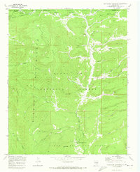
1970 Map of Rancho Del Chaparral
USGS Topo · Published 1973About this map
The Cañon de San Diego grant and the high country of the Santa Fe National Forest dominate this 1970 field-checked survey of the Jemez Mountains. The landscape is defined by the deep incisions of the Rio las Vacas and its many tributaries, including Peñas Negras and American Creek. Human presence is concentrated in a few specific enclaves, such as the Rancho del Chaparral and the remote Rio las Vacas Cabin, connected by an sparse network of jeep trails and the winding Telephone Trail. High-elevation landmarks like Smokey Bear Hill, Blue Bird Mesa, and the Red Top Lookout provide orientation across the heavily timbered terrain, while the northern boundary highlights the line between Rio Arriba and Sandoval counties.
Find a feature on this map
41 named features on this map. Tap any name to fly to it.
Don’t see what you’re looking for? This feature index may not catch every label — zoom into the map to look around manually.
Map Details
Editions of this 1970 Rancho Del Chaparral Map
This is the sole edition of this map. No revisions or reprints were ever made.
Other maps of this area

1890 · Jemes
USGS Topo · 1:125,000

1892 · Jemes
USGS Topo · 1:125,000

1909 · Gallina
USGS Topo · 1:125,000

1937 · Jemez Springs
USGS Topo · 1:48,000

1939 · La Ventana
USGS Topo · 1:62,500

1940 · Cuba
USGS Topo · 1:62,500

1943 · Cuba
USGS Topo · 1:62,500

1943 · La Ventana
USGS Topo · 1:62,500

1944 · Jemez Springs
USGS Topo · 1:62,500

1952 · Jemez Springs
USGS Topo · 1:62,500