
2023 Map of Randall
USGS Topo · Published 2023About this map
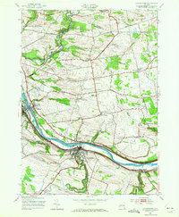
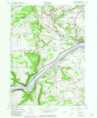
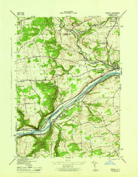
The Mohawk River carves a deep valley through this Montgomery County landscape, anchored by the riverside villages of Fonda and Fultonville. The river serves as a primary corridor for transportation and settlement, flanked by dramatic terrain features such as Big Nose and Little Nose. Away from the water, the terrain rises into upland areas where smaller hamlets like Sammonsville and Berryville are connected by a network of county roads and historical routes like Old Trail Rd and New Turnpike Rd.
Find a feature on this map
88 named features on this map. Tap any name to fly to it.
Don’t see what you’re looking for? This feature index may not catch every label — zoom into the map to look around manually.
Map Details
Editions of this 2023 Randall Map
This is the sole edition of this map. No revisions or reprints were ever made.
Historical Maps of Randall Through Time
15 maps found

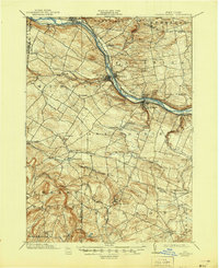
1898 Canajoharie
Montgomery County, NY

1900 Canajoharie
Montgomery County, NY
1902 Canajoharie
Montgomery County, NY
1943 Carlisle
Montgomery County, NY
1943 Esperance
Montgomery County, NY
1944 Canajoharie
Montgomery County, NY
1944 Randall
Montgomery County, NY
1945 Carlisle
Montgomery County, NY
1946 Canajoharie
Montgomery County, NY
1946 Esperance
Montgomery County, NY
1946 Randall
Montgomery County, NY

2023 Canajoharie
Montgomery County, NY

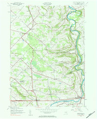
2023 Carlisle
Montgomery County, NY

2023 Esperance
Montgomery County, NY
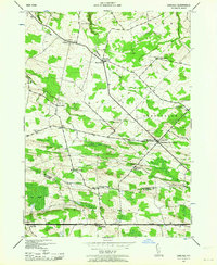
2023 Randall
Montgomery County, NY