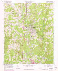
1970 Map of Randleman
USGS Topo · Published 1982About this map
The Deep River winds through the heart of Randolph County, anchoring a landscape of Piedmont textile towns and rural crossroads. This 1970s survey, updated with 1980s data, details the industrial and residential corridors connecting Randleman and Worthville with the northern outskirts of Asheboro. Along the riverbanks, the presence of a Filtration Plant and Sewage Disposal facility reflects the infrastructure supporting these riverside communities.
Find a feature on this map
39 named features on this map. Tap any name to fly to it.
Don’t see what you’re looking for? This feature index may not catch every label — zoom into the map to look around manually.
Map Details
Editions of this 1970 Randleman Map
2 editions found
Other maps of this area

1950 · High Point East
USGS Topo · 1:24,000

1951 · High Point East
USGS Topo · 1:24,000

1953 · Raleigh
USGS Topo · 1:250,000

1954 · Raleigh
USGS Topo · 1:250,000

1957 · Asheboro
USGS Topo · 1:62,500

1968 · Ramseur
USGS Topo · 1:24,000
1970 · Pleasant Garden
USGS Topo · 1:24,000
1970 · Climax
USGS Topo · 1:24,000

1970 · Randleman
USGS Topo · 1:24,000
1970 · Glenola
USGS Topo · 1:24,000