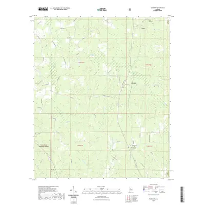
2021 Map of Randolph
USGS Topo · Published 2021About this map
Randolph sits at a crossroads of rail and river history, where the terrain transitions from the protected woodland of the Talladega National Forest in the southwest to the agricultural stretches of eastern Bibb County. This modern survey reflects a landscape shaped by long-standing rural community centers like Oakley and Bibb Mill. Significant genealogical detail is preserved through numerous burial sites, including the Union Baptist Church Cem and the Antioch Cem.
Find a feature on this map
60 named features on this map. Tap any name to fly to it.
Don’t see what you’re looking for? This feature index may not catch every label — zoom into the map to look around manually.
Map Details
Editions of this 2021 Randolph Map
This is the sole edition of this map. No revisions or reprints were ever made.
Other maps of this area

1890 · Bessemer
USGS Topo · 1:125,000

1891 · Clanton
USGS Topo · 1:125,000

1892 · Bessemer
USGS Topo · 1:125,000

1899 · Brookwood
USGS Topo · 1:125,000
1910 · Montevallo
USGS Topo · 1:62,500
1934 · Blocton
USGS Topo · 1:48,000
1940 · Blocton
USGS Topo · 1:62,500

1953 · Montgomery
USGS Topo · 1:250,000

1953 · Birmingham
USGS Topo · 1:250,000

1956 · Birmingham
USGS Topo · 1:250,000