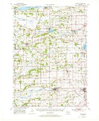
1955 Map of Randolph
USGS Topo · Published 1972About this map
Friesland and the rail-oriented villages of Cambria and Randolph anchor this mid-century topographic record, which captures a dense landscape of early agricultural and religious foundations. The map reveals a remarkable concentration of rural education, with over a dozen localized schools such as Welsh Prairie Sch, Stone Sch, and Healy Sch serving the surrounding township sections. Cultural heritage is deeply etched into the terrain through sites like Portage Prairie Cem and Blair Y Cae Cem, alongside numerous country chapels including Salem Ch and Rosedale Ch.
Find a feature on this map
70 named features on this map. Tap any name to fly to it.
Don’t see what you’re looking for? This feature index may not catch every label — zoom into the map to look around manually.
Map Details
Editions of this 1955 Randolph Map
2 editions found
Other maps of this area

1901 · Poynette
USGS Topo · 1:62,500

1902 · Portage
USGS Topo · 1:62,500

1915 · Neshkoro
USGS Topo · 1:48,000

1916 · Ripon
USGS Topo · 1:48,000

1918 · Neshkoro
USGS Topo · 1:62,500

1918 · Ripon
USGS Topo · 1:62,500

1955 · Randolph
USGS Topo · 1:62,500

1955 · Columbus
USGS Topo · 1:62,500

1955 · Beaver Dam
USGS Topo · 1:62,500

1955 · Fox Lake
USGS Topo · 1:62,500