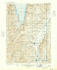
1912 Map of Randolph
USGS Topo · Published 1948About this map
Bear Lake anchors the northern portion of this landscape, its southern shoreline meeting Round Valley and the small settlement of Laketown. This early 20th-century survey documents the rural character of Rich County, Utah, where life was organized around the meandering course of the Bear River and its various tributaries like Otter Creek. The map records several established ranching outposts including Rex Ranch, Kennedy Ranch, and Enberg Ranch, which punctuate the valley floor between the Crawford Mountains and the high ridges of the Cache National Forest. In the southwest, the town of Woodruff serves as a hub near Big Creek, while Randolph sits centrally along the river flats. The presence of numerous springs like Canteen Spring and Sucker Spring highlights the importance of water sources in this high-altitude cattle country, providing a clear look at the early infrastructure of these mountain communities.
Find a feature on this map
68 named features on this map. Tap any name to fly to it.
Don’t see what you’re looking for? This feature index may not catch every label — zoom into the map to look around manually.
Map Details
Editions of this 1912 Randolph Map
3 editions found
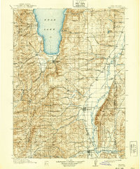
Other maps of this area

1909 · Montpelier
USGS Topo · 1:125,000

1911 · Montpelier
USGS Topo · 1:125,000

1912 · Randolph
USGS Topo · 1:125,000

1914 · Logan
USGS Topo · 1:125,000

1915 · Preston
USGS Topo · 1:96,000

1916 · Logan
USGS Topo · 1:125,000

1918 · Preston
USGS Topo · 1:125,000

1936 · Cokeville
USGS Topo · 1:96,000

1942 · Cokeville
USGS Topo · 1:125,000

1949 · Boulter Mts
USGS Topo · 1:24,000