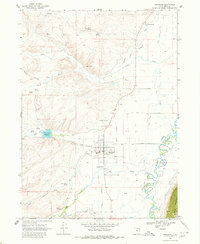
1968 Map of Randolph
USGS Topo · Published 1980About this map
Randolph serves as the focal point of this northern Utah landscape, situated in the heart of the Bear River valley. The town layout is characterized by its organized street grid, including Nor Gray Lane and Field Street, and functions as a local civic hub with the Randolph Ranger Sta, South Rich High Sch, and the Rodeo Ground. The map records an intricate irrigation system essential to the high-desert agriculture of Rich Co, featuring the Sage Creek Canal, the Woodruff Extension Canal, and the Big Creek Pump Ditch.
Find a feature on this map
41 named features on this map. Tap any name to fly to it.
Don’t see what you’re looking for? This feature index may not catch every label — zoom into the map to look around manually.
Map Details
Editions of this 1968 Randolph Map
2 editions found
Other maps of this area

1912 · Randolph
USGS Topo · 1:125,000

1954 · Ogden
USGS Topo · 1:250,000

1958 · Ogden
USGS Topo · 1:250,000

1960 · Ogden
USGS Topo · 1:250,000

1968 · Rex Peak
USGS Topo · 1:24,000

1968 · Randolph
USGS Topo · 1:24,000

1968 · Woodruff
USGS Topo · 1:24,000
1968 · Woodruff Narrows
USGS Topo · 1:24,000
1969 · Leefe
USGS Topo · 1:24,000
1969 · Birch Creek Reservoirs
USGS Topo · 1:24,000