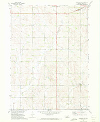
1971 Map of Randolph SW
USGS Topo · Published 1973About this map
Middle Logan Creek winds through the northeast corner of this Pierce County landscape, paralleled by the tracks of the Burlington Northern railroad. The area reflects a classic Midwestern agricultural survey grid, dotted with essential rural infrastructure that sustained the local farming community in the early 1970s. Key landmarks for local history include the Rose Hill Cem and educational sites like West Hill Sch and School No 46. Drainage patterns across the terrain are defined by the Yankton Slough, which cuts through the central and southern sections. This survey was conducted as part of the Department of the Interior program for the development of the Missouri River Basin, capturing the region's topography and land use during a period of established mid-century agricultural practice.
Find a feature on this map
9 named features on this map. Tap any name to fly to it.
Don’t see what you’re looking for? This feature index may not catch every label — zoom into the map to look around manually.
Map Details
Editions of this 1971 Randolph SW Map
2 editions found
Other maps of this area

1955 · Sioux City
USGS Topo · 1:250,000

1958 · Sioux City
USGS Topo · 1:250,000

1959 · Sioux City
USGS Topo · 1:250,000

1963 · Osmond
USGS Topo · 1:24,000

1963 · Wee Town
USGS Topo · 1:24,000
1963 · Pierce
USGS Topo · 1:24,000

1963 · Norfolk NE
USGS Topo · 1:24,000

1971 · Wausa
USGS Topo · 1:24,000

1971 · Randolph South
USGS Topo · 1:24,000

1971 · Randolph North
USGS Topo · 1:24,000