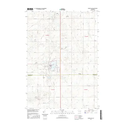
2016 Map of Random Lake
USGS Topo · Published 2016About this map
The village of Random Lake and its namesake water body serve as the central hub for this portion of the Wisconsin landscape, where the border between Sheboygan and Ozaukee counties meets. A dense network of local roads such as Indian Mound Rd and Hickory Grove Rd connects small agricultural communities like Adell and Dacada. The area is notably marked by its many parish burial grounds, including Saint Marys Cem and Saint Patrick Catholic Cem, reflecting the deep-rooted local history and community ties of the region. Natural features like the Adell Swamp and Silver Cr interrupt the structured grid of sections, while smaller basins like Spring Lake and Huiras Lake dot the southern terrain. This survey illustrates a modern transition point between established village centers and the surrounding dairy and farmland that has defined the county for generations.
Find a feature on this map
86 named features on this map. Tap any name to fly to it.
Don’t see what you’re looking for? This feature index may not catch every label — zoom into the map to look around manually.
Map Details
Editions of this 2016 Random Lake Map
This is the sole edition of this map. No revisions or reprints were ever made.
Other maps of this area

1892 · Port Washington
USGS Topo · 1:62,500

1904 · West Bend
USGS Topo · 1:62,500

1904 · Port Washington
USGS Topo · 1:62,500

1954 · Sheboygan Falls
USGS Topo · 1:62,500

1954 · Sheboygan Falls
USGS Topo · 1:24,000

1954 · Milwaukee
USGS Topo · 1:250,000

1955 · Kewaskum
USGS Topo · 1:62,500

1957 · Madison
USGS Topo · 1:250,000

1958 · Milwaukee
USGS Topo · 1:250,000
1958 · Port Washington East
USGS Topo · 1:24,000