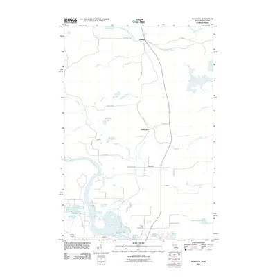
2011 Map of Randville
USGS Topo · Published 2011About this map
The Menominee River forms a complex hydrologic network along the Wisconsin-Michigan border, defining the southern portion of this landscape. The river system feeds into the Twin Falls Flowage and Badwater Lake, areas characterized by numerous small inlets and islands. Near the state line, the Spread Eagle Chain of Lakes includes Long Lake, East Lake, and South Lake, creating a dense cluster of water bodies that has long influenced local recreation and settlement patterns.
Find a feature on this map
62 named features on this map. Tap any name to fly to it.
Don’t see what you’re looking for? This feature index may not catch every label — zoom into the map to look around manually.
Map Details
Editions of this 2011 Randville Map
This is the sole edition of this map. No revisions or reprints were ever made.
Other maps of this area

1899 · Sagola
USGS Topo · 1:62,500

1939 · Iron Mountain
USGS Topo · 1:48,000

1941 · Iron Mountain
USGS Topo · 1:48,000

1947 · Iron Mountain
USGS Topo · 1:48,000

1947 · Lake Mary
USGS Topo · 1:24,000
1949 · Commonwealth
USGS Topo · 1:24,000

1954 · Iron Mountain
USGS Topo · 1:250,000

1954 · Escanaba
USGS Topo · 1:250,000

1955 · Norway
USGS Topo · 1:24,000

1955 · Norway
USGS Topo · 1:62,500