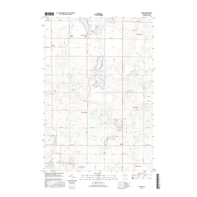
2015 Map of Range
USGS Topo · Published 2015About this map
The Apple River windsthrough this portion of Polk County, feeding into substantial impoundments such as Shiloh Flowage 151 and Apple River Flowage 134. The landscape is characterized by a high density of glacial lakes, including the prominent Big Blake Lake and Little Blake Lake in the north, and the central White Ash Lake. Small settlements like Range, Bunyan, and Fox Creek serve as local hubs for the surrounding agricultural and recreational lands. Genealogists will find significant local history at the Saint Marys Cem, Elim Cem, and Georgetown Cem, which are scattered among the township lines. The mapping of Townline Lake and Chelstrom Lake illustrates the natural drainage patterns of the region, where numerous small water bodies are connected by creeks like Rice-Bed Creek and the southern flow of the river system.
Find a feature on this map
81 named features on this map. Tap any name to fly to it.
Don’t see what you’re looking for? This feature index may not catch every label — zoom into the map to look around manually.
Map Details
Editions of this 2015 Range Map
This is the sole edition of this map. No revisions or reprints were ever made.
Other maps of this area

1950 · Balsam Lake
USGS Topo · 1:62,500

1950 · Turtle Lake
USGS Topo · 1:62,500

1951 · Cumberland
USGS Topo · 1:48,000

1951 · Frederic
USGS Topo · 1:48,000

1952 · Turtle Lake
USGS Topo · 1:62,500

1953 · Stillwater
USGS Topo · 1:250,000

1955 · Frederic
USGS Topo · 1:62,500

1955 · Stillwater
USGS Topo · 1:250,000

1956 · Cumberland
USGS Topo · 1:62,500

1958 · Stillwater
USGS Topo · 1:250,000