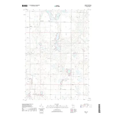
2018 Map of Range
USGS Topo · Published 2018About this map
Apple River and Fox Creek define this section of Polk County, where the landscape is marked by a complex network of glacial lakes and wetlands. Small settlements like Bunyan and Range sit within a grid of rural roads, including Mains Crossing Ave and E 130th Ave, which connect the scattered agricultural homesteads. The distribution of Georgetown Cem, Saint Marys Cem, and Elim Cem provides essential spatial data for genealogists tracing local families in the vicinity of Big Blake Lake and White Ash Lake. The numerous water bodies, including Shiloh Lake and Townline Lake, suggest a terrain shaped by post-glacial drainage patterns that have historically dictated the placement of roads and farmsteads.
Find a feature on this map
45 named features on this map. Tap any name to fly to it.
Don’t see what you’re looking for? This feature index may not catch every label — zoom into the map to look around manually.
Map Details
Editions of this 2018 Range Map
This is the sole edition of this map. No revisions or reprints were ever made.
Other maps of this area

1950 · Balsam Lake
USGS Topo · 1:62,500

1950 · Turtle Lake
USGS Topo · 1:62,500

1951 · Cumberland
USGS Topo · 1:48,000

1951 · Frederic
USGS Topo · 1:48,000

1952 · Turtle Lake
USGS Topo · 1:62,500

1953 · Stillwater
USGS Topo · 1:250,000

1955 · Frederic
USGS Topo · 1:62,500

1955 · Stillwater
USGS Topo · 1:250,000

1956 · Cumberland
USGS Topo · 1:62,500

1958 · Stillwater
USGS Topo · 1:250,000