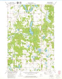
1978 Map of Range
USGS Topo · Published 1979About this map
The Apple River and its various tributaries wind through this Polk County landscape, which in the late 1970s was characterized by a dense network of lakes and glacial depressions. Small communities like Range and Bunyan anchor the rural infrastructure, surrounded by a distribution of country churches and family burial grounds including St Marys Cem, Georgetown Cem, and Elim Cem. These features reflect the enduring settlement patterns of northern Wisconsin's agricultural and timber-adjacent communities.
Find a feature on this map
39 named features on this map. Tap any name to fly to it.
Don’t see what you’re looking for? This feature index may not catch every label — zoom into the map to look around manually.
Map Details
Editions of this 1978 Range Map
This is the sole edition of this map. No revisions or reprints were ever made.
Other maps of this area

1950 · Balsam Lake
USGS Topo · 1:62,500

1950 · Turtle Lake
USGS Topo · 1:62,500

1951 · Cumberland
USGS Topo · 1:48,000

1951 · Frederic
USGS Topo · 1:48,000

1952 · Turtle Lake
USGS Topo · 1:62,500

1953 · Stillwater
USGS Topo · 1:250,000

1955 · Frederic
USGS Topo · 1:62,500

1955 · Stillwater
USGS Topo · 1:250,000

1956 · Cumberland
USGS Topo · 1:62,500

1958 · Stillwater
USGS Topo · 1:250,000