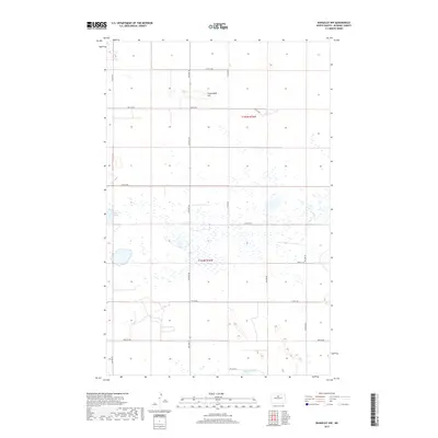
2017 Map of Rangeley NW
USGS Topo · Published 2017About this map
Copperdahl Hill rises above a glaciated landscape defined by numerous small prairie potholes and seasonal wetlands in this 2017 study of north-central McHenry County. The terrain is structured by a strict section-line road grid, including 4th Ave NE and 57th St NE, which facilitates the region's agricultural activity. Two primary water bodies, Heffner Lake in the west and Lauinger Lake at the southern boundary, serve as key geographic anchors amidst a dense network of marshes and smaller ponds. The map captures the boundary between T155n R76w and T154n R76w, illustrating how the Public Land Survey System continues to dictate the layout of rural North Dakota long after the initial homesteading era.
Find a feature on this map
17 named features on this map. Tap any name to fly to it.
Don’t see what you’re looking for? This feature index may not catch every label — zoom into the map to look around manually.
Map Details
Editions of this 2017 Rangeley NW Map
This is the sole edition of this map. No revisions or reprints were ever made.
Other maps of this area

1949 · Denbigh
USGS Topo · 1:24,000

1950 · Karlsruhe NE
USGS Topo · 1:24,000

1950 · Towner
USGS Topo · 1:24,000

1950 · Denbigh
USGS Topo · 1:24,000

1954 · Towner SE
USGS Topo · 1:24,000

1954 · Minot
USGS Topo · 1:250,000

1955 · Rangeley NW
USGS Topo · 1:24,000

1955 · Rangeley NE
USGS Topo · 1:24,000

1957 · Karlsruhe
USGS Topo · 1:24,000

1957 · Rangeley SE
USGS Topo · 1:24,000