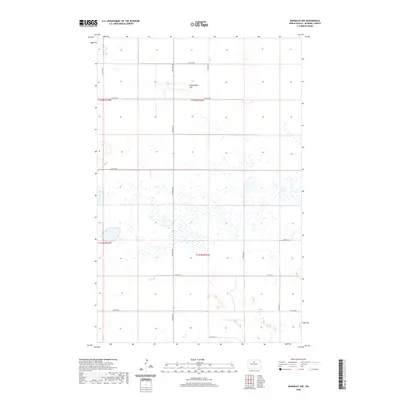
2020 Map of Rangeley NW
USGS Topo · Published 2020About this map
Copperdahl Hill rises above a sprawling landscape of wetlands and prairie potholes in this modern survey of McHenry County. The terrain is defined by a dense network of small water bodies and seasonal wetlands, typical of the drift prairie region, which are intersected by a strictly maintained section-line road grid. Major local thoroughfares such as 6th Ave NE and 57th St NE provide the primary access through this sparsely populated agricultural area. The map illustrates the precision of the Public Land Survey System, showing the boundaries between Township 155 North, Range 77 West and its neighbors. This 2020 edition offers a clear look at the contemporary rural infrastructure and natural drainage patterns of the North Dakota plains.
Find a feature on this map
16 named features on this map. Tap any name to fly to it.
Don’t see what you’re looking for? This feature index may not catch every label — zoom into the map to look around manually.
Map Details
Editions of this 2020 Rangeley NW Map
This is the sole edition of this map. No revisions or reprints were ever made.
Other maps of this area

1949 · Denbigh
USGS Topo · 1:24,000

1950 · Karlsruhe NE
USGS Topo · 1:24,000

1950 · Towner
USGS Topo · 1:24,000

1950 · Denbigh
USGS Topo · 1:24,000

1954 · Towner SE
USGS Topo · 1:24,000

1954 · Minot
USGS Topo · 1:250,000

1955 · Rangeley NW
USGS Topo · 1:24,000

1955 · Rangeley NE
USGS Topo · 1:24,000

1957 · Karlsruhe
USGS Topo · 1:24,000

1957 · Rangeley SE
USGS Topo · 1:24,000