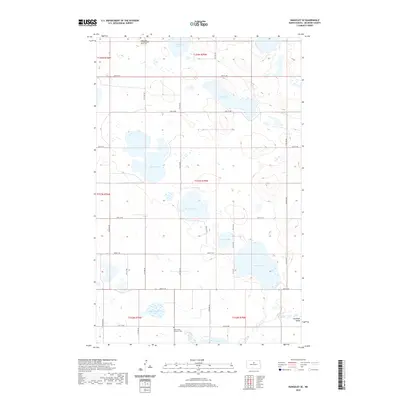
2020 Map of Rangeley SE
USGS Topo · Published 2020About this map
Saint John of Blumenfeld South Cem and Saint Johns Lutheran Cem anchor the social and historical landscape of this McHenry County prairie. The map reveals a post-glacial terrain defined by numerous bodies of water, including the large Lake Lemer, Bromley Lake, and Round Lake. This hydrographic pattern suggests a landscape where agriculture must navigate a series of basins and wetlands, particularly near the southeastern edge of Antelope Valley. The regular grid of county roads, such as 48th St NE and 41st St NE, provides a structured counterpoint to the organic shapes of Duckshire Lake and Long Lake. This modern survey by the U.S. Geological Survey reflects a sparsely populated rural district where local identity is tied to small community burial grounds and the natural geography of the North Dakota plains.
Find a feature on this map
26 named features on this map. Tap any name to fly to it.
Don’t see what you’re looking for? This feature index may not catch every label — zoom into the map to look around manually.
Map Details
Editions of this 2020 Rangeley SE Map
This is the sole edition of this map. No revisions or reprints were ever made.
Other maps of this area

1930 · Drake
USGS Topo · 1:62,500

1940 · Aylmer
USGS Topo · 1:62,500

1954 · Minot
USGS Topo · 1:250,000

1954 · McClusky
USGS Topo · 1:250,000

1955 · Rangeley NW
USGS Topo · 1:24,000

1955 · Rangeley NE
USGS Topo · 1:24,000

1957 · Rangeley SE
USGS Topo · 1:24,000

1957 · Rangeley
USGS Topo · 1:24,000

1958 · McClusky
USGS Topo · 1:250,000

1958 · Minot
USGS Topo · 1:250,000